
Introduction
In recent years, aerial photography and videography with drones have become a transformative force in various industries. From construction and oil and gas to real estate and agriculture, the ability to capture high-quality images and videos from the sky offers numerous benefits. This article explores the impact of drone technology on these sectors, focusing on key applications such as construction site monitoring, oil and gas inspection, and progression coverage, with a special emphasis on the booming opportunities in Louisiana.
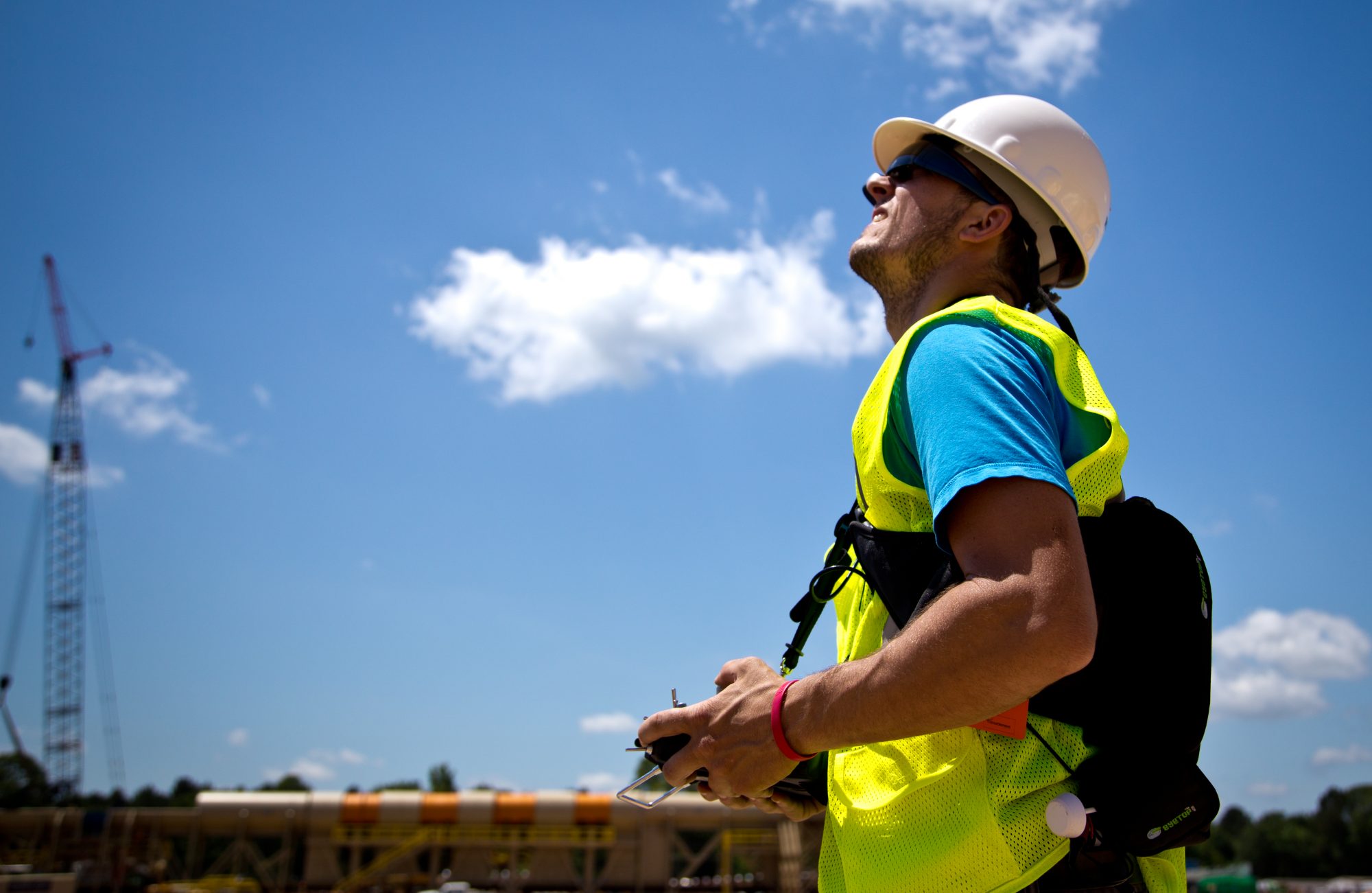
Aerial Photography and Videography in Construction
Drones have revolutionized the construction industry by providing an efficient and cost-effective way to monitor site progress and ensure safety. Aerial photography and videography allow project managers to obtain comprehensive views of construction sites, facilitating better decision-making and planning.
Key Benefits:
- Progress Tracking: Drones enable real-time progress tracking by capturing detailed aerial images and videos. This helps project managers to monitor the advancement of construction phases, identify potential issues early, and ensure that the project stays on schedule.
- Safety Inspections: Safety is a paramount concern in construction. Drones can inspect hazardous areas without putting workers at risk, capturing high-resolution footage that can be analyzed to improve safety protocols.
- Surveying and Mapping: Drones equipped with advanced sensors and GPS technology can create accurate 3D maps and models of construction sites. This aids in site planning, layout design, and volumetric measurements.
Drone Applications in the Oil and Gas Industry
The oil and gas sector has also embraced drone technology for various applications, significantly improving operational efficiency and safety.
Key Benefits:
- Pipeline Inspection: Drones equipped with thermal imaging cameras can detect leaks and corrosion in pipelines, providing a non-invasive and cost-effective inspection method. This reduces downtime and enhances preventive maintenance efforts.
- Site Monitoring: Aerial photography and videography allow for comprehensive monitoring of oil and gas facilities. Drones can capture footage of remote and hard-to-reach areas, ensuring that all parts of the facility are regularly inspected.
- Emergency Response: In case of emergencies such as oil spills or gas leaks, drones can quickly assess the situation and provide real-time data to emergency response teams, aiding in swift and effective decision-making.
Progression Coverage and Other Applications
Beyond construction and oil and gas, aerial photography and videography with drones offer valuable applications in various other industries.
Real Estate:
- Property Listings: High-quality aerial photos and videos enhance real estate listings, providing potential buyers with a unique perspective of the property and its surroundings. This can significantly boost the property’s marketability.
- Land Development: Drones assist in land development projects by offering detailed surveys and topographic data, facilitating better planning and design.
Agriculture:
- Crop Monitoring: Drones equipped with multispectral sensors can monitor crop health, identify areas affected by pests or diseases, and optimize irrigation practices. This leads to increased crop yields and reduced costs.
- Precision Agriculture: Aerial imagery allows farmers to implement precision agriculture techniques, applying fertilizers and pesticides more efficiently and minimizing environmental impact.
Contact Us for Aerial Photography and Videography Services in Louisiana
If you are in Louisiana and looking for top-notch aerial photography and videography services for construction, oil and gas, real estate, or agriculture, we are here to help. Our experienced team uses the latest drone technology to deliver high-quality images and videos tailored to your specific needs. Whether you need detailed progress tracking for a construction project, comprehensive site monitoring for an oil and gas facility, or stunning aerial shots for a real estate listing, we have you covered. 318.599.9876
Conclusion
The integration of aerial photography and videography with drones into various industries has opened up new possibilities for efficiency, safety, and innovation. In construction, drones offer unparalleled progress tracking and safety inspections. In the oil and gas sector, they provide crucial pipeline inspections and site monitoring. Additionally, drones are enhancing real estate marketing and transforming agricultural practices.
As drone technology continues to advance, its applications will expand further, driving the evolution of multiple industries. Businesses that embrace this technology will gain a competitive edge, benefiting from the unique insights and efficiencies that aerial photography and videography provide.